Hey guys, I’m new to ChartFactor, and so I’m exploring ChartFactor Studio to learn how to take advantage of its features. The thing is, I created a new application and loaded into it the Chicago Taxi Trips sample dashboard that Studio provides.
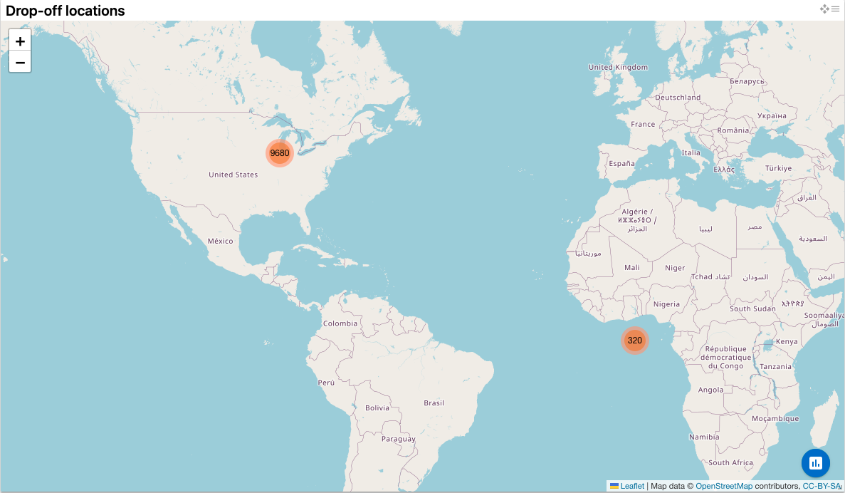
It seems to me a very interesting dashboard, it has some visualizations that are quite complete to show the information in a pleasant way. Now, I see that some markers are being shown on the map in the sea, and I suppose it is because they have some values of the dropoff_latitude and dropoff_longitude fields that are incorrect or undefined.
Hi @thomas, what happens is that this demo dashboard, as you have rightly stated, has some records with invalid latitude and longitude information. When this happens, the Map sets those records to the value of [0,0] as latitude and longitude and that is why you see the markers in the sea which is the center of coordinates. In these cases, what you can do is configure the ignoreCords property as follows:
.set('ignoreCords', [0, 0])
Take a look at the documentation so you can dig a little deeper into some interesting properties of the Map.
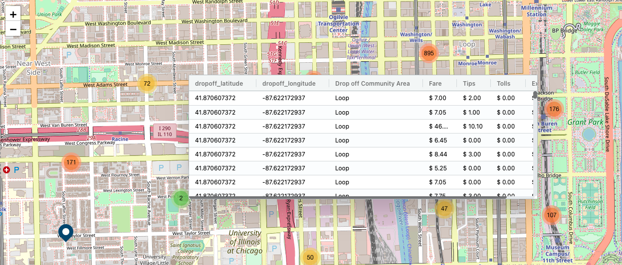
Hello @juan.dominguez, after applying that property I no longer got the coordinates in the Sea, it worked wonders. I was also reviewing the properties that appear in the documentation, and I applied the maxSpiderifyMarkers property since some groups have many markers, I loved the way the information is displayed in a table, it is much easier to visualize it.